


Up with sun, clean up and tear down camp. Traveling scenic back route through the Davis Mountains , along I-10 for 30 miles then north on TX 54 to the Guadalupe Mountains National Park and to Carlsbad, NM. As I made it to I-10, I needed gas so pulled into the only station at the interchange. Gas price was a little high and they were selling 86 octane since we’re higher in elevation. (national avg. 2.829 – paid 3.149).
From my turnoff from I-10 to Guadeloupe Mountains is 55 miles. I only passed about 25 cars and 15 trucks going the other way along the entire stretch. Since it is a low traveled road, wherever the natural washes occurred the road dipped, sometimes for a few feet others for a hundred yards. Sometimes the dips were smooth transitions while others were much more severe. They were generally signed to be taken at 45 MPH.
The road goes through the edge of the national park and crosses several high peaks. We encountered many signs warning of cross winds and strong wind currents ahead. Great views from a road side park with an elevation marker and monument indicating the elevations of the surrounding peaks.
Pulled into the Carlsbad campground which is at elevation 3075 on the south side of town. After setting up, drove into town to explore.
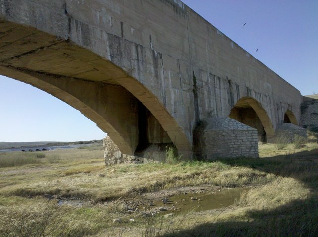
At the north end of town there is a historic flume which is essentially a bridge to carry water across a river. It feeds the areas aqua duct irrigation system and is famous for taking the Pecos River across itself. The headwaters are just upstream and intercepted at the higher elevation before some water overflows into the river.
Ran through Wal-Mart for some supplies before heading back to walk Sunny and watch 24.
No comments:
Post a Comment